Navionics Web App: Ultimate Guide to Boaters, Navigators and Charting
The Navionics Web App is a powerful online tool for marine navigation, offering detailed nautical charts and advanced route planning features. Designed for boaters, anglers, and adventurers, it ensures safer and more efficient exploration of waterways.

The Navionics Web App is an essential tool for marine enthusiasts, offering advanced features for navigation, planning, and real-time charting. This innovative platform provides seamless access to detailed nautical charts, enhancing the safety and convenience of water-based adventures. In this article, we explore the features, benefits, and usability of the Navionics Web App, giving you everything you need to know to optimize your maritime experiences.
What is the Navionics Web App?
The Navionics Web App is a browser-based tool designed to provide users with access to interactive marine and lake charts. Developed by Navionics, a leader in navigation technology, this app allows users to:
- Explore detailed nautical charts for seas, rivers, and lakes.
- Plan routes and waypoints for efficient navigation.
- Access real-time updates and community edits for improved accuracy.
Compatible with multiple devices, the Navionics Web App ensures that boaters and navigators can access critical data anytime, anywhere.
Key Features of the Navionics Web App
1. High-Resolution Nautical Charts
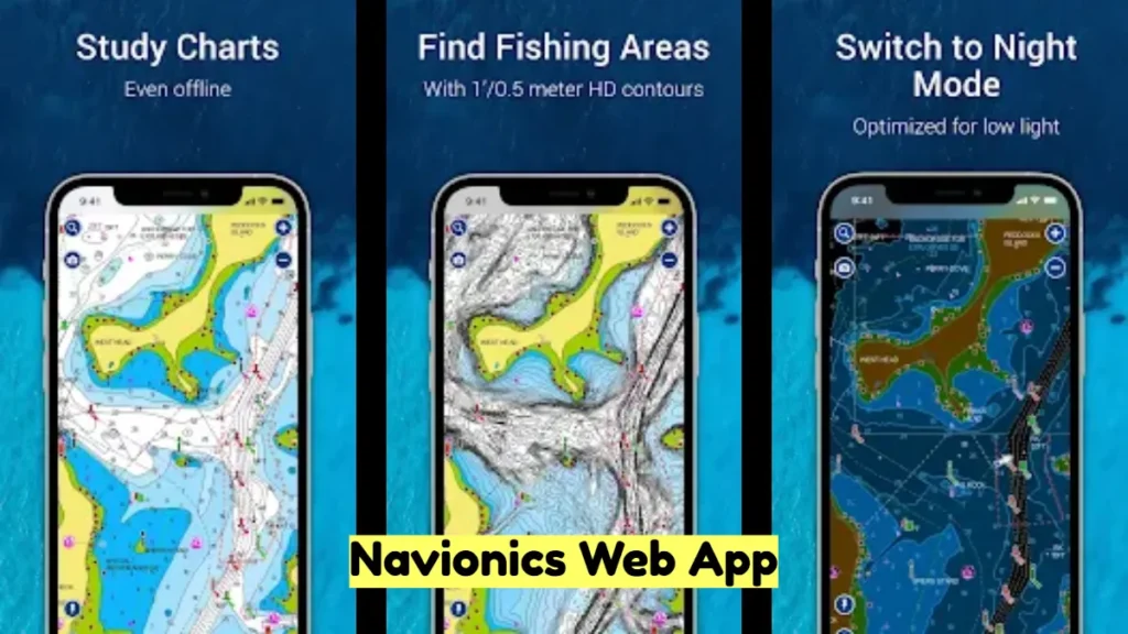
The Navionics Web App offers high-resolution charts that display bathymetry, contours, and essential navigational markers. These charts include:
- Depth shading for easy identification of shallow areas.
- Buoys, lighthouses, and markers for safe navigation.
- Detailed harbor plans for docking convenience.
2. Route Planning and Waypoint Management
Users can efficiently plan their journeys by setting routes and waypoints. The app calculates the most direct paths while considering hazards and navigational restrictions, ensuring safe and efficient travel.
3. Community Edits and Real-Time Updates
One standout feature is the integration of user-generated content through community edits. Boaters can:
- Share updates on changing conditions.
- Access real-time data for obstacles or temporary hazards.
- Benefit from the collective knowledge of the Navionics community.
4. Weather Overlay
The app provides real-time weather overlays, including wind speed, temperature, and precipitation. This feature helps users make informed decisions based on current and forecasted weather conditions.
5. Device Compatibility and Synchronization
The Navionics Web App syncs seamlessly with mobile devices, tablets, and GPS plotters. This ensures continuity in navigation data across all platforms, enhancing convenience and reliability.
How to Use the Navionics Web App
Step 1: Access the Web App
Navigate to the official Navionics website and launch the web app from your browser. No installation is required, making it accessible from any device with internet connectivity.
Step 2: Explore Charts
Use the intuitive interface to zoom in and out of charts, explore depths, and identify navigation markers. Users can switch between standard nautical charts and sonar charts for more detailed bathymetric data.
Step 3: Plan Your Route
- Click on your starting point on the map.
- Add waypoints by selecting additional destinations.
- Save the route for future reference or sync it with your Navionics mobile app or GPS plotter.
Step 4: Monitor Real-Time Data
Activate overlays such as weather updates or sonar imagery to get a comprehensive view of current conditions. Adjust plans as necessary based on updated information.
Benefits of Using the Navionics Web App
1. Enhanced Safety
With accurate charts and real-time data, the app significantly reduces the risk of accidents, ensuring safer navigation.
2. Cost-Effective Solution
Unlike traditional chart books, the Navionics Web App is a cost-effective alternative, offering regular updates without requiring frequent purchases.
3. User-Friendly Interface
Its intuitive design caters to both novice and experienced navigators, making it easy for anyone to plan and execute voyages.
4. Community Collaboration
The integration of community edits fosters collaboration, allowing users to benefit from shared knowledge and experiences.
Who Should Use the Navionics Web App?
The Navionics Web App is ideal for:
- Recreational Boaters: Plan leisure trips with confidence using detailed charts and weather updates.
- Professional Mariners: Optimize navigation routes for commercial operations.
- Anglers: Identify prime fishing spots using bathymetric and sonar data.
- Adventurers: Explore new waters with the assurance of accurate and updated information.
Subscription and Pricing
While the basic version of the Navionics Web App is free, a subscription unlocks premium features such as:
- Advanced map overlays.
- Regular chart updates.
- Offline access for mobile devices.
Pricing plans are affordable, ensuring accessibility for all users.
Conclusion
The Navionics Web App is an indispensable tool for anyone involved in marine navigation. Its cutting-edge features, user-friendly interface, and real-time data integration make it a standout choice for boaters and navigators worldwide. Whether you’re a seasoned sailor or a weekend adventurer, the Navionics Web App empowers you to explore with confidence.
Read also: Richard Grenell Net Worth: Career, Income, and Financial Insights


